We live on Sal — the flat, dry, sun-baked island that most people picture when they think of Cabo Verde. Santo Antão is everything Sal is not: dramatic, green, mountainous, and the kind of place where Swiss guests who spend their weekends in the Alps look out from a viewpoint and say it looks like something out of a painting. We have been twice and would go back without needing a reason. If you are coming to Cabo Verde and you skip Santo Antão, you have missed half of what this archipelago is.
Getting There: Fly to Mindelo, Ferry to Porto Novo
Santo Antão has no functioning public airport. The old Agostinho Neto Airport in Ponta do Sol closed years ago — you can still see the abandoned runway and control tower on the hillside above the village, a ghost of an infrastructure that could not compete with the terrain around it. There are plans for a new airport; at the time of writing, the ferry remains the only way in.
Santo Antão is easily accessible from São Vicente via a one-hour ferry crossing from Mindelo to Porto Novo. This means your journey to Santo Antão always starts in Mindelo — which is itself worth more than a one-night stopover. Mindelo is Cabo Verde's cultural capital: music, architecture, some of the best restaurants in the archipelago, the kind of energy that Sal's resort economy does not produce. Build at least one proper day there on each side of the Santo Antão crossing.
Four ferries operate daily in each direction — two morning and two afternoon departures — run by two competing companies. The tickets are inexpensive and easy to purchase at the counter at the Mindelo pier or at Porto Novo on arrival. Unlike some ferry connections in Cabo Verde, the ferry costs about 1,100 escudos one way — approximately €10 — and the crossing is reliably on schedule. For the Cabo Verde inter-island network, this reliability is notable and worth mentioning specifically. Buy your return ticket when you arrive; there is no reason not to.
On our second visit we took our quad from Sal to Mindelo by cargo ferry and then crossed to Porto Novo with it. Great fun on the old road, though for hiking purposes a private vehicle creates more logistical complexity than it solves — more on that below.
The Island at a Glance
Santo Antão covers 785 square kilometres, making it the second largest island in Cabo Verde after Santiago. The island is divided into north and south by a mountain range long considered impenetrable. The highest point is Topo de Coroa at 1,979 metres.
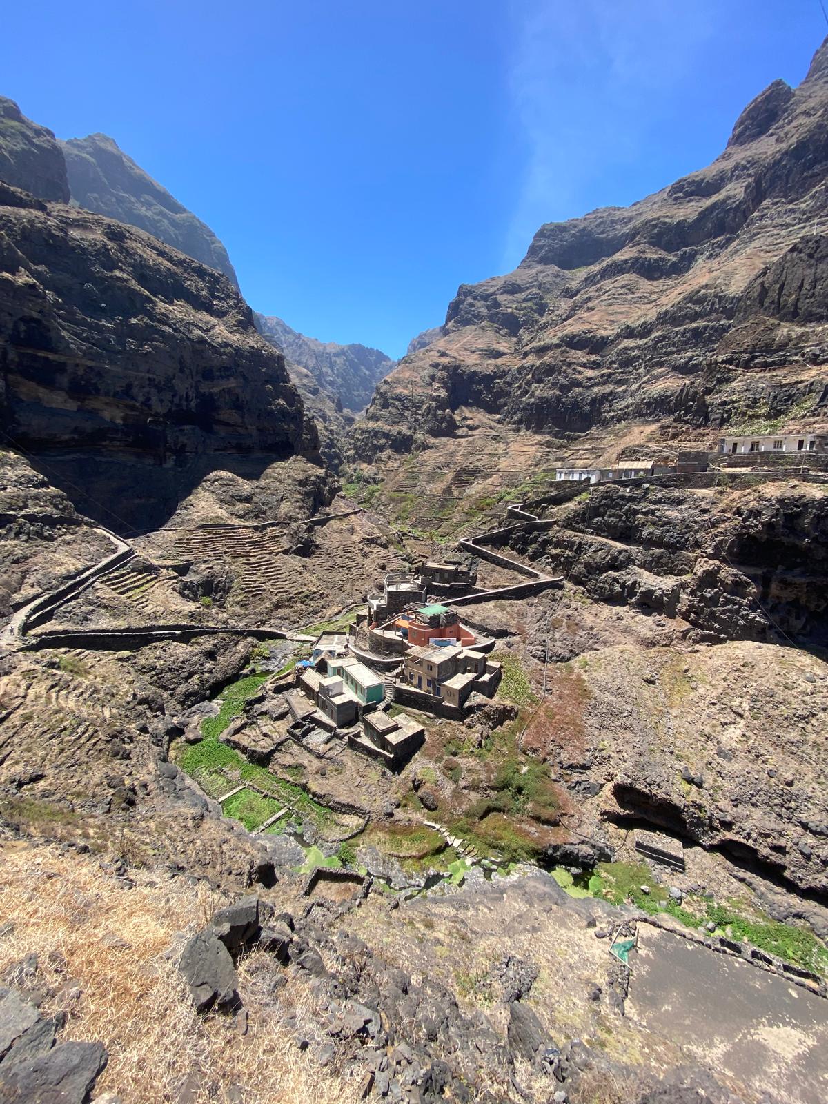
The two halves of the island could not be more different. The north is green, dramatic, terraced, and alive — sugarcane fields, banana palms, vegetable gardens cultivated on slopes so steep that machinery is impossible and every metre of cultivation represents generations of manual labour. The south is dry, rocky, and lunar in character — beautiful in a completely different register, but not what most visitors come for.
The people of Santo Antão are primarily mountain people who live mainly from agriculture. The island's sugarcane is grown mainly for grogue production — the national Cabo Verdean spirit — and mills continue to distill it in the Paul Valley. Colonisation began in 1548, and in the 17th century, settlers from Santiago, Fogo, and northern Portugal founded Ribeira Grande in the north of the island.
The Old Road: Thirty Years and Centuries of Importance
The Old Road used to connect the harbour of Porto Novo to Ribeira Grande on the other side of the mountain range and was built in the 1960s. The mountains were considered too steep to build a coastal road, so the only option was to go over the top.
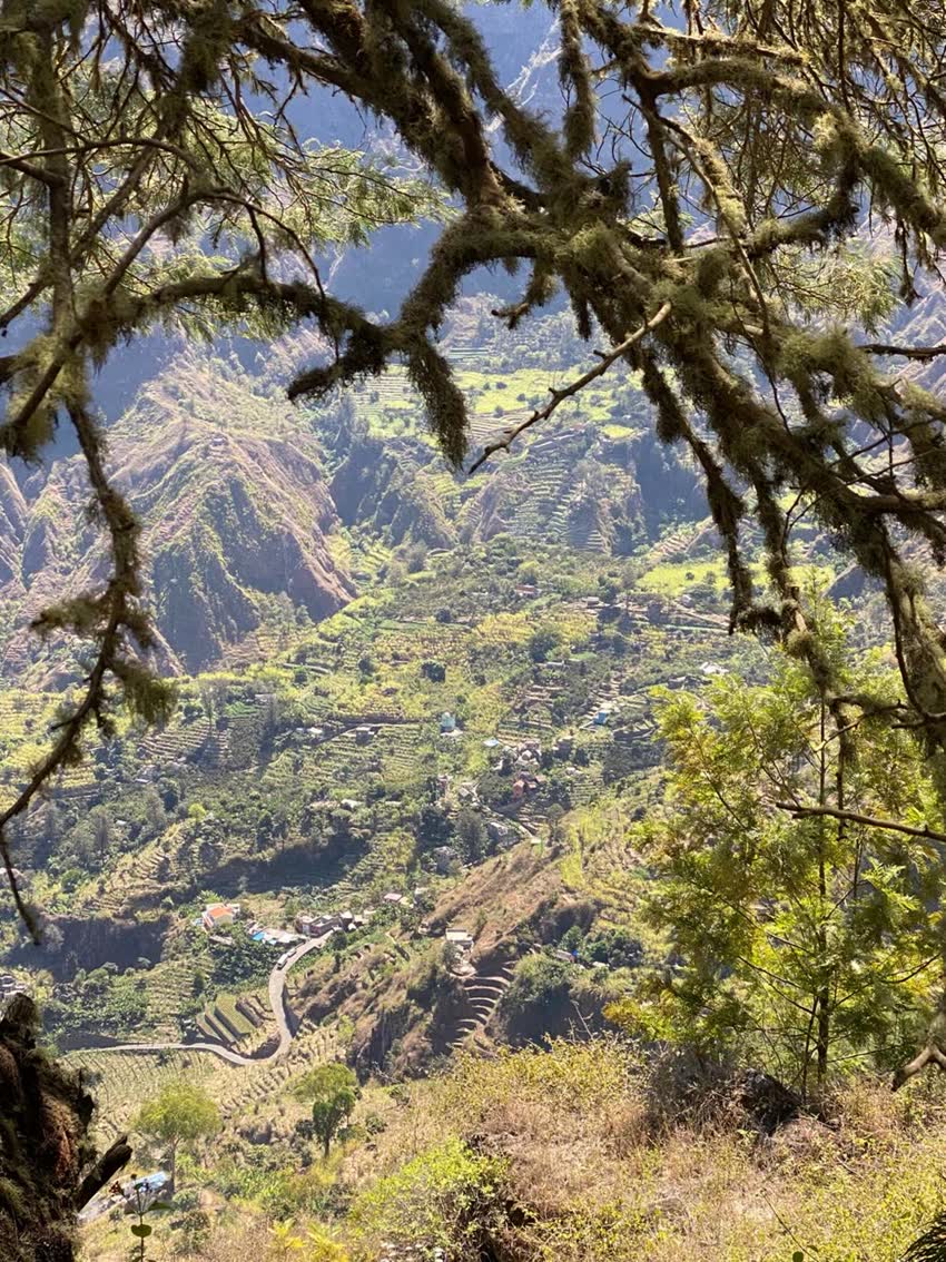
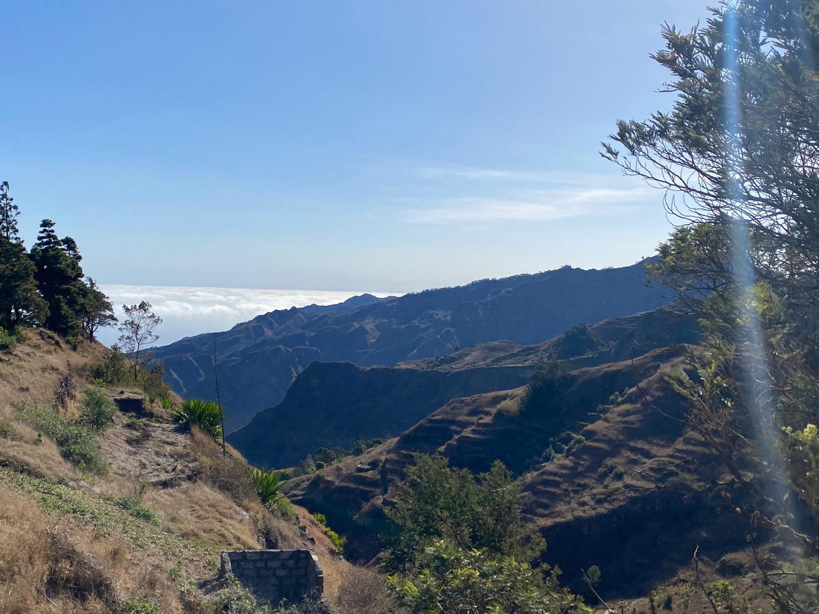
The construction took decades — the cobblestones were laid by hand over terrain that most engineers would have considered impassable, rising from Porto Novo through increasingly dramatic switchbacks to a ridge that tops out above the clouds before descending into the green north. The road winds its way to a high ridge from where the slopes drop steeply and deeply in both directions, with views that are simply breathtaking. Pines, mimosas, cypresses and eucalyptus line the upper sections. The landscape shifts from arid southern desert to tropical northern green within the space of a single mountain crossing.
The new coastal road, completed in 2021, now provides a faster and more comfortable connection along the southern and western coast. It is scenic, well-engineered, and saves significant time. But the old road is something else entirely — a piece of engineering history that doubled as the island's lifeline for decades, with viewpoints that justify stopping the car every kilometre.
Our strong recommendation: take the new road when heading north to maximise time in the hiking areas, and take the old road on the return to Porto Novo. Or vice versa. Do both. They are different experiences and each deserves the full attention it rewards.
The Two Hikes You Cannot Skip
1. Cova Crater Down to Paul Valley
This is the downhill hike that Santo Antão is most famous for, and the reputation is earned completely. The Vale de Paúl is an evergreen, lush valley — one of the most beautiful walks leads from the Cova crater, a vast circular caldera, down to Lombo Comprido along a paved serpentine mule track that zig-zags down the mountain sides.
The Cova crater is a volcanic caldera at around 1,500 metres altitude with a diameter of about 1 kilometre. A small village sits inside the caldera, its soils particularly fertile due to high precipitation from the trade winds. Standing at the rim of Cova and looking down into the valley below — the descent stretching for hundreds of metres through terraced fields, sugar cane, and the occasional village — you understand immediately why people describe Santo Antão as otherworldly.
The hike descends through the valley to the village of Paul, typically taking between 3 and 5 hours at a comfortable pace. The scenery changes with every hundred metres of altitude lost. The views back up towards the crater rim, looking at how far you have come, are as impressive as the views forward towards the valley floor.
Two honest caveats. First: your knees will feel it for the next two to three days. The gradient is sustained, the path is paved but not always even, and the cumulative impact of several hundred metres of descent on an uneven surface is real. Trekking poles help considerably. Second: this is a one-way hike. You will need transport at the bottom in Paul. See the section on drivers below.
2. Cruzinha to Ponta do Sol: The Coastal Path
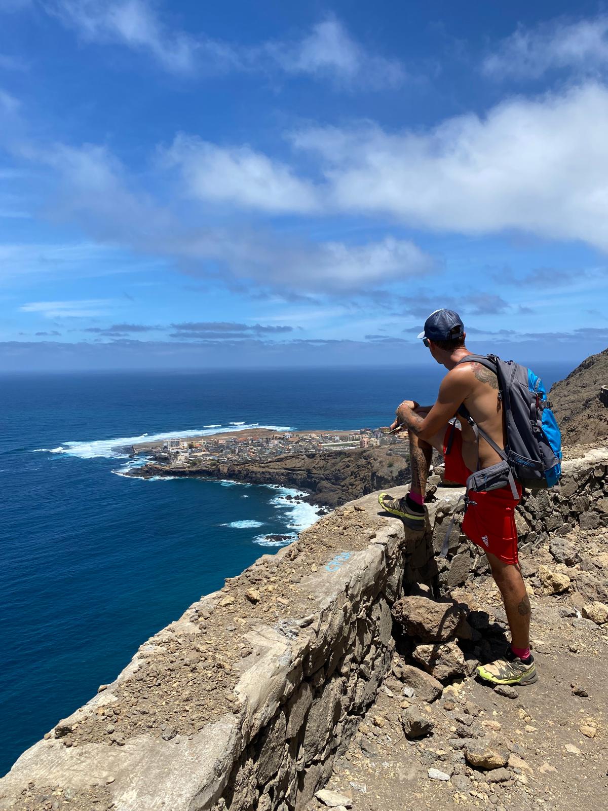
The second essential hike follows the coast from Cruzinha — a small village accessible from Ribeira Grande — all the way to Ponta do Sol along a path that clings to dramatic volcanic cliffs above the Atlantic.
The path passes through a succession of small, charming villages. It was historically the only connection between these coastal settlements and the larger towns — the road the locals still use for school, for market, for everything. In places the path drops into small valleys occupied by villages that feel entirely removed from any version of the modern world. Children walking home from school on a route that most visitors would describe as a serious hike. Houses built directly onto volcanic rock. The Atlantic crashing against the black cliffs far below.
People often ask whether the hike works in either direction. Technically yes — the coast runs both ways. Our recommendation is to walk from Cruzinha to Ponta do Sol rather than the reverse, specifically because Ponta do Sol is where you want to finish.
At the end of the hike in Ponta do Sol, Caleta restaurant is waiting. Good food, excellent drinks, views over the ocean from a terrace that earns every superlative it receives. Ponta do Sol is a quiet, picturesque village with a small fishing port and beautiful mountain backdrop. Arriving there after six hours of coastal walking, sitting down at Caleta with a cold drink and the Atlantic in front of you, is one of those travel moments that justifies the entire effort of getting to the island. Book ahead, particularly in season. The restaurant is known and fills up.
The Hikes You Have Not Heard Of
The marked trails on Santo Antão attract most visitors. The unmarked ones are where the island reveals itself most completely.
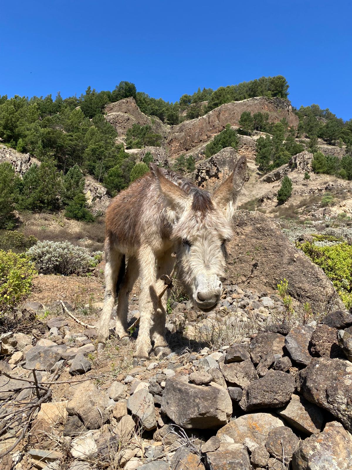
We hiked with a local guide through mountain villages with no electricity and no running water — communities where life has not changed in any recognisable way for generations. Children playing in the fields, women working in gardens on near-vertical slopes, goats finding footholds on rock faces that look impossible. No other tourists. No signage. No infrastructure oriented towards visitors at all.
These hikes are not on any map you will find online. The paths are not marked. Finding them without someone who knows them is genuinely difficult. The reward is experiencing a Cabo Verde that tourism has not reached and that, with any luck, will take some time yet to find.
A local guide is essential for this kind of exploration. Ask at your accommodation in Ponta do Sol or Paul — the community of guides on the island is small and connected, and a good recommendation travels quickly. We have the contact of one of the best guides on the island. Reach out if interested.
The Transport Question: Get a Private Driver
This deserves direct advice rather than a suggestion. Get a private driver.
collective mini-buses of Cabo Verde — aluguers — connect the main towns and can be found at the central squares. They are cheap, authentic, and an experience in themselves. They also run on their own schedule, cannot wait at a trailhead for six hours, and do not cover the more remote starting or finishing points of the island's best hikes. After a full day of hiking you do not want to spend an additional hour trying to find an aluguer back to wherever you are staying.
On our first trip we partly tried to manage the logistics with aluguers and taxis. It worked, partially, and wasted time we would have preferred to spend in the mountains. From that moment we arranged a private driver and the difference was immediate. The driver dropped us at the start of each hike, was at the finish point when we arrived, knew which routes were currently passable, and had local knowledge that no guidebook contains. The cost is not significant — a private driver for a day on Santo Antão is not an expensive proposition relative to what you are spending to be on the island — and the improvement in the quality of the day is substantial.
Where to Stay
Ponta do Sol is our recommendation and we hold this view after two visits. The promenade offers the best sundowner positions on the island. Caleta makes every evening there better than it would otherwise be. The village is small enough to feel genuine and large enough to have everything you need. Several guesthouses and small hotels operate here, ranging from very simple to comfortable. Book ahead in season.
Paul has good options directly in the valley and makes a logical base for the Cova descent and the surrounding Paul Valley hikes. Several restaurants and bars serve the village. The atmosphere is quieter than Ponta do Sol and entirely pleasant.
Ribeira Grande — the largest town of the north, known locally as Povoação — is the administrative and commercial centre. Even though many of Ribeira Grande's buildings are new, several examples of Portuguese colonial architecture remain. It is functional, has better shopping and services than the smaller villages, and sits at the junction of several hiking routes. The charm is different from Paul or Ponta do Sol — more town, less village — but a practical base for anyone planning to cover a wide range of the northern trails.
The Grogue Distilleries
Stop at a local grogue distillery and do a tasting. This is not a recommendation in the fine spirits sense — grogue is an acquired taste and the distillery process is more agricultural than artisanal by most visitors' reference points. It is a recommendation in the cultural sense. The production of grogue from sugarcane is the island's most important agricultural tradition, carried on in the Paul Valley as it has been for generations.
The distilleries are typically small family operations. They generally welcome walk-in visitors, take some time to show the process — the crushing of cane, the fermentation, the distillation — and offer a taste at the end. Whether the taste itself converts you to grogue is beside the point. The context of tasting it where it is made, by the people who make it, in a valley that smells of sugarcane, is the experience. It costs almost nothing and is entirely authentic.
The South: A Different Island
The south of the island is dry and desert-like — a landscape of deep gorges and lunar rock that reminds visitors of somewhere entirely different from the green north. There are a few guesthouses along the southern coast and the beach at Tarrafal de Monte Trigo on the western tip is genuinely beautiful and genuinely remote. Most visitors come for the north and its hiking; the south is for those who want to see the full range of what the island contains or who specifically want the remote quiet of a coast that tourism has essentially not reached.
If you have only a few days, concentrate on the north. If you have a week, consider a day or two in the south — the contrast is as striking in its own way as the green valleys are in theirs.
Our Honest Assessment
Santo Antão does not have the convenience of Sal. There is no international airport, no resort strip, no consistent wifi, no guarantee that the thing you are looking for will be available in the place you are. This is entirely the point.
Spend any time on Santo Antão and you grow accustomed to a raucous soundtrack — the thrashing of the ocean, the relentless trade winds rattling the sugarcane, the music floating from farmhouses and car stereos. Then occasionally, sheltered from the wind and the waves, a silence that reveals Cabo Verde as it actually is: a long way from the world, held by the ocean, unchanged in the ways that matter.
We have had Swiss guests who spend their weekends in the Alps describe specific viewpoints on Santo Antão as something out of a painting. That reaction — from people who have seen dramatic mountain landscape more times than most — tells you what the island is capable of delivering.
If you are coming to Cabo Verde and you have the time: go to Mindelo first. Then take the ferry to Santo Antão. Hike the Paul Valley descent and the Cruzinha to Ponta do Sol coastal path. Sit at Caleta at the end of the second day. Have a grogue at a distillery in Paul.
Then stay another day, because you will want to.